Toaster-Sized Satellites Will Revolutionize How We Measure World Food Supply
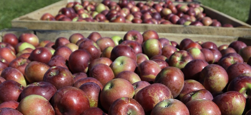
Bins of apples wait to be transported to a barn after being harvested at Goold Orchards on Thursday, Sept. 26, 2013, in Castleton, N.Y. Mike Groll/AP


2,900 people visit 125,000 American farmers each year to survey them about their expected yields.
Behind every box of Kellogg’s Corn Flakes is an army of iPad-wielding crop scouts.
Funded by U.S. taxpayers, these 2,900 people (most of them sexagenarian part-timers) visit 125,000 American farmers each year to survey them about their expected yields. The results of their work—estimates of how much corn, soybean and wheat the U.S. will produce in a given year—dictate the market prices of the commodity foods that people and livestock eat. For more than a century, this method has been the most reliable way the U.S. can measure its food supply. Until now.
“As it turns out, there’s a lot of satellite imagery out there that very few people have looked at,” says Mark Johnson, CEO and co-founder of Descartes Labs, a startup that wants to overhaul how such data is gathered.
For two years, Johnson has been working in Los Alamos, New Mexico, at the former site of the Manhattan Project, to develop a method for data collection that relies not on humans but on a system of high-flying satellites.
At least 40 years of NASA Landsat imagery already exist in the public domain, with millions more pictures being added each year. Descartes has been using that database to teach its computers how to find information buried in the images, for example by removing cloud cover to get granular data about crops.
But the company will soon add another tool to its arsenal: high-resolution imagery taken by 200 toaster-size satellites that will be launched into space later this summer by a group called Planet Labs.
There are many reasons for the public and private sector to want more accurate data. Better figures would allow farmers to respond quickly to large-scale harvest failure, especially as they grapple with a changing climate that has led to prolonged droughts.
For companies that can pay to get data updates from Descartes—think massive groups like Archer Daniels Midland and ConAgra—improved information could also mean a leg-up over the competition when buying or stocking up on grain.
Crop data also helps food companies determine the amount of grain that will be available for processing. Congress used such data when considering its most recent $489 billion Farm Bill package, and tractor and seed companies use it to determine which supplies they’ll need to produce and where.
The toaster-size satellite approach could also be more cost-effective. In 2016, the Agriculture Department spent $42 million on traditional crop scout data collection, which is managed by the National Association of the State Departments of Agriculture.
Johnson says his company can do the same work, better, for a fraction of the cost. (As proof, he points to the annual crop production estimate report that Descartes Labs released in July 2015, one month ahead of the USDA’s own report.) Descartes also claims to be more accurate than the USDA, which conceded that between 1981 and 1998, its soybean projections and final totals were off by about 4 percent.
“Thanks to the numbers that we released last year, we’ve definitely gotten serious interest from the agriculture community,” Johnson says. Descartes Labs received $8.38 million from investors in 2015, including $5 million from agricultural venture capitalist group Cultivian Sandbox Ventures.
What remains to be seen is whether a constellation of satellites can replace work that’s always been done with boots on the ground. Even if new technology changes the way crops are analyzed by the government, NASDA says there will still be a need for human scouts, whose surveys also include pollinator, local food and land value data collection, among other things.
“This is probably a great way to make the data more robust,” says Andy Hecht, an commodities analyst with Carden Capital. “[But] when you talk to the farmer, you get a better sense for crop diseases and things like that. Satellite imagery isn’t going to pick that up … and I wouldn’t want to throw that variable out.”