FAA rolls out no-drone zones


The agency released new data detailing drone flight restrictions around airports and military bases and has begun a process that could further restrict private drone use.
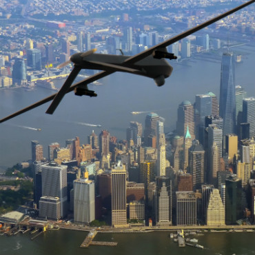
The Federal Aviation Administration has rolled out its first restricted flight rules aimed at unmanned aerial systems, marking off areas around airports, military bases and possibly critical infrastructure and intelligence facilities.
The FAA said on April 11 that it is poised to release its first set of map data that the mushrooming flock of private UAS operators can use to safely navigate their aircraft around commercial airports.
The announcement comes only a few days after the agency pushed out map data restricting drones over military bases across the country and only a couple of months after the agency reported that the number of close calls between commercial aircraft and unmanned aircraft almost doubled in the last six months compared to the same period last year.
In the April 11, the FAA said it will release the first in a series of "facility maps" that show areas and altitudes near airports where the small aircraft can operate safely. The maps, it said, will also help operators comply with the agency's Part 107 airspace authorization rules, which are now nearly a year old.
In a separate announcement on April 7, the FAA and the Defense Department unveiled an interactive map that shows new restrictions on drone operations over 133 military bases across the U.S. The agencies said the restrictions were put in place because of national security concerns and are the first airspace restrictions that specifically apply to unmanned aircraft. Violating the boundaries, said the agencies, could result in civil penalties and criminal charges.
Under the new military base restrictions, UAS can't be operated within 400 feet of the boundaries of the military facilities. The restrictions take effect April 14.
The FAA and the Department of Transportation are also setting up a process to accept petitions to restrict or prohibit drones from operating over critical infrastructure facilities.
That process was mandated by the FAA Extension, Safety, and Security Act of 2016, it said. The agencies said on April 7 they "are currently evaluating options to implement such a process."
Additionally, the agency said it is considering more requests for drone flight restrictions from federal security and intelligence agencies.
The FAA hopes its new maps for drone operations near airports will be used by drone operators to complete their Part 107 operations application, by being able to tailor their request to align with specific locations and altitudes in line with approved UAS airspace.
The maps will be informational only, said the FAA, and they do not automatically authorize flights. Using them also doesn't guarantee authorization applications will be approved, it said.
The agency said would release the airport restriction maps in phases over the next year.
The first release on April 27 will contain about 200 maps, with subsequent maps released through the map database, with the release to sync up with the agency's existing 56-day aeronautical chart production schedule.